Short Description
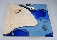
This topographical relief map of Shanghai, China was generated using the Geographic Resources Analysis Support System Geographical Information System or GRASS GIS. This system manages, analyzes, and processes geospatial data to provide the topographic contours and maps of public roads that were cut, etched, stained, and assembled in think[box].
Contact
Subsite
Sears think[box]
Image

